Call Now
Call Now
Call Now
Time
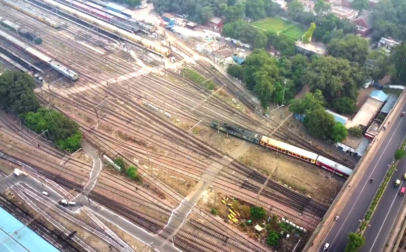
We are specialised in detail project report (DPR), final location survey, engineering services, aerial services and monitoring. Our UAV/drone technology-based services in railways are route alignment survey, topographical survey and mapping, asset tagging, GIS survey, GPR survey, LiDAR surveys, track videography, encroachment analysis, mapping of railway yards and sheds, station, and depot layout planning. Our inspection and monitoring services are construction progress monitoring, soil investigation, component inspection, bridge inspection to ease the complex project with high precision and accuracy. We are having expertise in airborne sensors like airborne LiDAR and airborne multispectral.
We employ software-led equipment for aerial surveying, mapping, 3D modelling, property tax collection, environmental monitoring, infrastructure inspection, traffic analysis, emergency response, disaster management, public engagement, solar potential assessment, archaeological site mapping, and urban surveillance. They enhance transportation planning, public engagement, solar potential assessment, and urban surveillance.