Call Now
Call Now
Call Now
Time
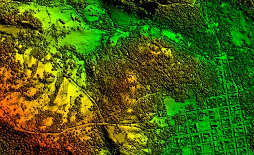
Digital Surface Models, or DSMs, represent the topography of the earth’s surface, including all objects on it, such as trees, buildings, and other features. DSMs are created using aerial data capture methods, like LiDAR (Light Detection and Ranging) or photogrammetry. LiDAR uses laser beams to measure the distance between the sensor and the ground, while photogrammetry uses aerial photographs to create 3D models.
There are many benefits of DSMs. For one, they accurately represent the earth’s surface, allowing users to accurately measure features and make decisions based on that information. 3D visualization of the Earth’s surface allows users to see the surface and features in a more realistic and immersive way. This is particularly useful in applications such as urban planning and design where visualizing the impact of planned developments on the existing landscape is critical.
Digital surface models offer several advantages over traditional topographic mapping. Because DSMs are typically created using LiDAR or photogrammetry, they provide high-resolution data. This means that DSMs can capture much more detail than traditional topographic maps, often based on field surveys, and may not accurately capture all features. The high-res data also provides highly accurate elevation measurements. This allows for more precise calculations of slope, aspect and other terrain characteristics, essential for industries that model water flow and drainage.