Call Now
Call Now
Call Now
Time
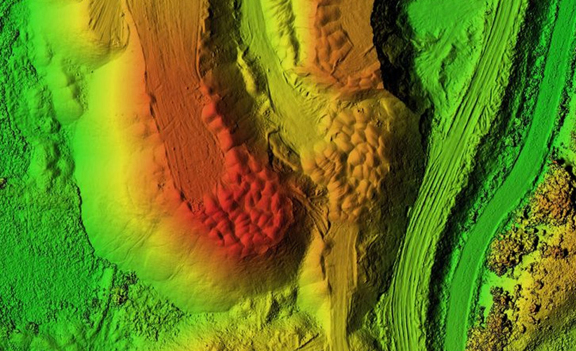
A Digital Terrain Model (DTM) is a digital representation of the terrain or ground surface of a specific area or location. It is a three-dimensional model that provides information about the elevation, slope, and other topographic features of the terrain.
DTMs are created using digital elevation models (DEMs), which are datasets that provide information about the elevation of the ground surface. DEMs are typically generated using remote sensing technologies such as LIDAR, which use laser pulses to measure the distance between the ground and the sensor.
DTMs are an important tool for a wide range of industries, including surveying, engineering, and environmental management. They provide a detailed and accurate representation of the terrain, which can help improve the accuracy and efficiency of many different types of projects.