Call Now
Call Now
Call Now
Time
A point cloud is a collection of data points defined by a given coordinate system. In the context of mapping and surveying, point clouds are often generated using technologies such as LiDAR (Light Detection and Ranging) or photogrammetry. These technologies capture millions of points in three-dimensional space, representing the surface of objects or terrain in great detail.
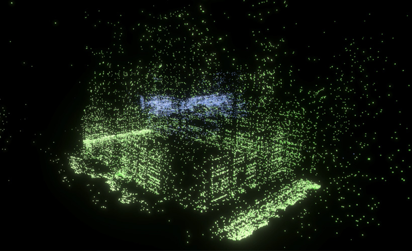
A point cloud is a detailed digital representation of an object or space, consisting of numerous points positioned in a 3D coordinate system. Primarily, point clouds accurately record the surfaces of the objects they represent, with the points covering the visible external structures of these objects. The data points are specifically located on the visible surfaces where the laser scanner's beam is reflected. Depending on the size and distribution of points, the point cloud can visually appear as a continuous surface or a collection of individual points, with our brains adeptly perceiving the object's shape. Each point is independent and possesses distinct positional and color attributes, making point clouds easy to manipulate, display, and filter. Notably, the computer calculates only the position and color of the points, simplifying the processing of point cloud data.
When collecting data for a point cloud, ensuring good visibility of scanned areas and surfaces is crucial. 3D laser scanners operate by sweeping the laser beam to measure the distance to an object. However, the scanner cannot capture points from surfaces that are not visible to it. Therefore, comprehensive scanning of the object from multiple positions is necessary to cover the entire point of interest and combine the scans into a single point cloud file. The density of a point cloud, characterized by the distance between points, influences the resolution of the data. A lower point cloud density allows for faster on-site data capture during 3D laser scanning. Additionally, point clouds often include visual properties such as colors and reflectivity, which impact the time required for laser scanning surveys and the size of the resulting output file